Course Details
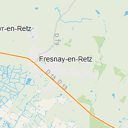
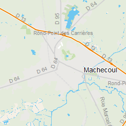
Machecoul – V9 - groupe 1
Elevation
DELETE THIS COURSE
Machecoul – V9 - groupe 1
16.25 km
Distance--
Avg Pace--
Goal Time


Map Layers
Course Elements
Help
Planning Climbs
Understanding Climb Details
As you’re planning your course, you can view specific details of each climb to help you prepare for the difficulty of your ride.
How to View Climb Details
Know Your Climbs
Climb icons appear on your map at the start of every categorized climb. Tap the climb icon to see climb details.
Your map view identifies all categorized climbs available in your area with climb icons. Tap into the icon to see climb difficulty, average grade, distance, total ascent, percent paved and a detailed elevation chart.
About Climb Categories
Ranking Climb Difficulty
Climb categories are calculated by:
Climb length (m) x climb average grade (%)
Climbs within the same category will vary in length and grade. Within the same category, you’ll see both shorter and steeper climbs, as well as longer and flatter climbs. The categories are listed below in order from easiest to most difficult. (Note: Climb categories do not consider altitude, grade variability or surface.)
Easy (Uncategorized)
These are the flattest climbs. They won't take a significant effort compared to categorized climbs.
Category 4
The easiest of the categorized climbs. At shorter distances, they’re fairly flat and manageable (~3 km = 3-5% avg grade). These climbs won’t get much longer than 5 km, and they’ll remain feeling relatively flat.
Category 3
At shorter distances, these climbs are very difficult (~3 km = 10.5% avg grade). They reach their max length at about 10 km. As they get closer to that length, they start to feel relatively flat (~3% grade). However, you’ll have to endure that grade for longer.
Category 2
At shorter distances, these climbs will have very difficult to extreme grades (~3 km = 10.5-12% avg grade). At a climb length of 10 km, you’ll have a 3-4% average grade. They reach their max length at ~16 km, with ~3% avg grade.
Category 1
Attempt these only with targeted training and experience. At shorter lengths, these climbs are extremely challenging grades to tackle (~3 km = 16% avg grade). At longer lengths, you’ll still have grades difficult for almost all riders (~10 km = 5-6% avg grade). It’s possible to find these climbs as long as 20+ km.
Hors Catégorie (HC)
Hors Catégorie translates to “Beyond Categorization”. These are the most difficult of all climbs. They’re either the longest, the steepest or both. They’re as tough to find as they are to complete. At shorter lengths, HC climbs will hit extreme grades (~5 km = 12.5% avg grade). It’ll be difficult to find an HC climb shorter than 5 km, as the grade would get insurmountable. At longer distances (~10 km+), grades will be difficult and grueling. There’s no upper limit to the difficulty of HC climbs. They’re found as long as 65.5 km+ with an avg grade of ~6%.
About Climb Grade
Difficulty of Grades
A climb’s average grade is an average measure of how steep or flat the incline is over the entire length of that climb.
The feeling of difficulty of a climb is subjective. Perceived difficulty will change based on many variables (e.g. rider fitness and ability, gearing, total distance of the climb, whether the ride is paved or unpaved, etc.).
Here are general descriptions of how different grades may feel during a ride:
<3%
3%-6%
6%-9%
9%-12%
12%+
Flat or nearly flat
Manageable, but getting difficult
Difficult
Very difficult
Extreme
Note: These descriptions are skewed toward the feeling of road rides, rather than off-road trail rides.
Climb grade is similar but different than climb category.
Climb grade is one factor in calculating a climb’s category. Although climb grade and climb category are both measures of difficulty, climb category also considers the length of the climb, giving a more complete picture of difficulty.
Create Courses with Climbs
Customize Your Map
As you’re creating a course, filter your map to show only the climb categories that are relevant to you.
Use the climb difficulty slider to create a custom filtered map. View only the climbs you’re interested in riding, or view only the climbs that you want to avoid. To see more precise details for each climb (such as the exact grade, distance and total ascent), tap into it from the map view.